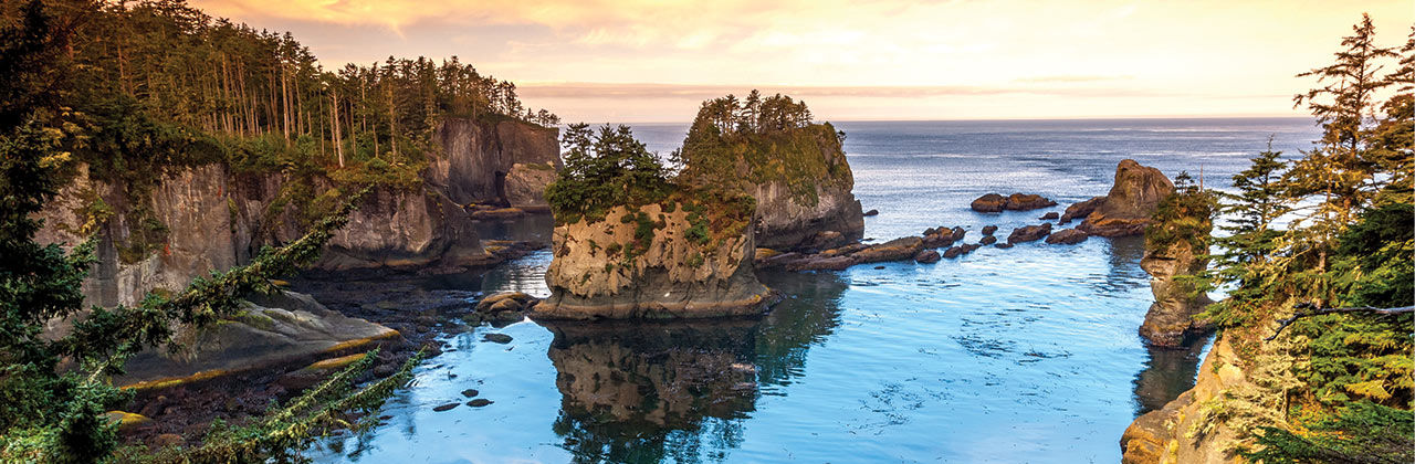
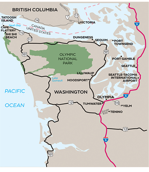
The northwest tip of the contiguous United States lies in Makah territory at Cape Flattery. Here, the Pacific Ocean slams into the Strait of Juan de Fuca, which divides the U.S. and Canada, and occasionally, in winter, even whips up 25-foot waves.
But in more mellow seasons, the area attracts tide-poolers, surfers, and sea kayakers, especially at sandy Hobuck Beach, 3.5 miles southwest of Neah Bay. The town also has a trail for land-based whale watching, as well as a museum and an ethnobotanical garden that celebrate the local Native culture.
Hikers should purchase the tribe’s annual recreation permit in town ($20 per vehicle) before hitting Cape Flattery’s 1.5-mile round-trip trail to a cliffside viewpoint. (Savvy travelers download maps, as cell and GPS signals on the peninsula can be spotty.)
Open year-round, this kid-friendly trail also welcomes dogs. Rustic boardwalks wind through fern-fletched woods and between lookout points, which can reveal double-crested cormorants and bald eagles among the rocky sea stacks. Keep an eye out for chocolate-brown California sea lions sunning and squabbling on the rocks of Tatoosh Island.
Once the site of a summer village where tribe members dried fish and launched whaling canoes, this tiny island later housed the Cape Flattery Lighthouse and weather station, which was used to eavesdrop on Japanese transmissions during World War II.
Offshore, Flattery Rocks National Wildlife Refuge protects nesting sea birds, including tufted puffins, and kelp beds where voracious sea otters hunt for food. The refuge is closed to the public.
Backpackers and photographers gravitate to another route, too: the 8-mile round-trip hike to Shi Shi Beach and a stunning array of sea stacks at Point of Arches. This route passes into Olympic National Park, so make sure to bring a wilderness permit, as well as the tribe’s recreation pass.